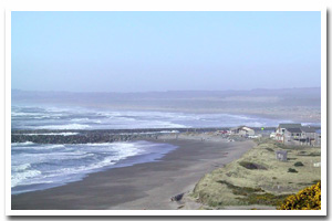
About the Bandon Sandy Shore
Here identified as the Bandon littoral cell, this sandy 35 mile segment of Oregon's coastal shoreline extends from mileage Cape Arago to Cape Blanco. It is associated with the Coquille and Sixes rivers mouth(s) and accompanying Coquille River Estuary.
The Bandon sandy shore lies within Coos and Curry County and makes up the shoreline fronting the communities of Bandon. It consists of Dune Backed, Inlet Affected and Bluff Backed shoreline. Of this shoreline approximately 9.1% is urban and 45.7% is park. An unknown percentage of this stretch of sandy shoreline is hardened with shore protection structures. Predominant land uses include those typical of urban, ruralsettings.
Chronic coastal hazards for the Bandon sandy shore include ocean flooding and erosion, inlet migration, landsliding and sloughing and spit breaching. Catastrophic hazards include earthquakes, and the groundshaking, subsidence, landsliding, liquefaction, and tsunami that accompany them.
Key recreational facilities and cultural features include: Bullards Beach State Park, Cape Blanco State Park and Face Rock and the Coquille River Lighthouse. |
Data for the Bandon Sandy Shore
[37 Records Listed]
Bandon Littoral Cell GIS Data |
Data Layer |
Source |
Scale |
Year |
Download |
|
OCMP |
20,000 |
1924 |
|
|
OCMP |
20,000 |
1924 |
|
|
OCMP |
20,000 |
1925 |
|
|
OCMP |
20,000 |
1928 |
|
|
OCMP |
1,200 |
2001 |
|
|
DOGAMI |
1,200 |
2002 |
|
|
OCMP |
1,200 |
2002 |
|
|
OCMP |
1,200 |
2002 |
|
|
OCMP |
1,200 |
2002 |
|
|
OCMP |
1,200 |
2002 |
|
|
OCMP |
1,200 |
2002 |
|
|
OCMP |
1,200 |
2002 |
|
|
OCMP |
1,200 |
2002 |
|
|
OCMP |
1,200 |
2002 |
|
|
OCMP |
1,200 |
2002 |
|
|
OCMP |
1,200 |
2002 |
|
|
OCMP |
1,200 |
1967 |
|
|
OCMP |
1,200 |
1967 |
|
|
OCMP |
1,200 |
2001 |
|
|
OCMP |
1,200 |
2001 |
|
|
OCMP |
1,200 |
1967 |
|
|
OCMP |
1,200 |
2002 |
|
|
OCMP |
1,200 |
2002 |
|
|
OCMP |
1,200 |
2002 |
|
|
DLCD |
1,200 |
2002 |
|
|
USGS |
24,000 |
1994 |
|
|
USGS |
24,000 |
1994 |
|
|
USGS |
24,000 |
1994 |
|
|
USGS |
24,000 |
1994 |
|
|
USGS |
24,000 |
1993 |
|
|
USGS |
24,000 |
1973 |
|
|
USGS |
24,000 |
1999 |
|
|
USGS |
24,000 |
1999 |
|
|
OCMP |
24,000 |
2007 |
|
|
ODOT |
6,000 |
1967 |
|
|
ODOT |
6,000 |
1967 |
|
|
ODOT |
6,000 |
1967 |
|
[37 Records Listed]
Information provided by the Oregon Coastal Management Program |